Showing posts with label marker. Show all posts

Tuesday, February 4, 2025

Escaped Rebel officers came ashore at this remote Virginia beach. A new marker tells the story -- but you need to earn the view by a long walk in state park

Jason Saffer adjusts Va. marker (Civil War Trails) and Florida wreckage of Maple Leaf (at left, Library of Congress)
Most of Civil War Trails’ 1,530 markers are just a short walk from a parking lot. But there are many you have to work a little harder to reach.

For example, you must ride a boat to see one on St. Clement’s Island in the Potomac River or take a rigorous hike along the Appalachian Trail to soak in others.

Now the Williamsburg, Va.-based nonprofit has erected a marker in likely its most remote location, says executive director Drew Gruber.

Virginia State Parks announced last week the addition of the new panel at False Cape State Park below Virginia Beach. To get there, pedestrians or bicyclists must venture six miles beyond a parking lot, over a dune, past a primitive campground and head for the Atlantic Ocean surf.

Visitors will learn about how Confederate officers overcame unarmed guards on the Maple Leaf transport ship in 1863, escaped and eventually made their way to friendly lines.

“People have already been making the trek,” Gruber told the Picket. “Besides hiking to the site where these POWs landed you can also take a tram tour ...”

Star shows location of marker and trail map shows proximity to camping area, ocean (Civil War Trails, Va. State Parks)
The escape from the Maple Leaf is labeled as a point of interest on the park’s trail map.

“Now having a physical marker at the location enables us to preserve the Civil War history of False Cape and lets park guests explore learn, and embrace the lessons of courage and unity from this daring account,” said Rachel Harrington, chief of visitor experience at the park, in the news release.

Not everyone breaks a sweat to reach the marker. Harrington told the Picket a tram the park operates features a four-hour guided tour. The open-air Blue Goose Tram goes fairly close to the site of the landing and informs participants of the Civil War history.

The Civil War episode took place in June 1863, when 97 captured Rebel officers were being taken on the vessel Maple Leaf from Fort Monroe, Va., to Fort Delaware, then to a Northern prison camp. They quickly took control of the transport ship from 12 soldiers carrying unloaded muskets.

They did not have enough coal to flee to the Bahamas and after sailing south for about 30 miles some 70 officers decided to land small boats on what is now the state park, said Harrington. (About 27 captives stayed on board)

The soldiers split up and headed toward friendly lines in nearby North Carolina. Despite heavy Union cavalry pursuit and the challenges of the Great Dismal Swamp, they rendezvoused in Weldon, N.C., before taking a train to Richmond, Va. Local sympathizers gave them a hand during their odyssey.

“After a 12-day journey, the officers arrived in the Confederate capital, where they told tales of their bold feat,” the marker reads. “After resting and receiving back pay, they returned to their units.”

The Maple Leaf returned to Federal service but ran into more bad luck in April 1864 when it struck a torpedo in the St. Johns River near Jacksonville, Fla.

“The explosion tore the bow of the ship apart, ripping through the deck and killing four soldiers," according to the National Park Service. “The vessel sank quickly, but apart from those lost in the explosion there were no other fatalities.

The shipwreck was not salvaged, but  thousands of artifacts were recovered in the 1980s and 1990s. Many are on exhibit at the Mandarin Museum nearby.

Civil War Trails
promotes tourism, working with local governments, parks and visitor bureaus. It has another sign about the Maple Leaf below Currituck, N.C.

Virginia Beach tourism leaders hope the Maple Leaf marker and other attractions will help draw tourists to the Sandbridge area near the North Carolina border during the offseason.

False Cape State Park features about six miles of beaches. (At right, park manager Austin Monnett and chief ranger Rachel Harrington.) It offers guided kayak trips, primitive camping, interpretive programs, hiking and biking trails

Public vehicular access at the state park is prohibited. Visitors should park at Back Bay National Wildlife Refuge's parking lot at 4005 Sandpiper Road, Virginia Beach, to begin their hike or ride and to reach the visitor center. The cost to park is $5. Tram tours cost $8 and require a reservation. They operate year round, but run more frequently from April through October. Click here for more information.

Friday, May 3, 2024

The scrappy 'Jersey Boys' are getting their due with a sign at Battle of Williamsburg site in Virginia. Here are events tied to Sunday's 162nd anniversary

Steve Barnes and Don Klein of Williamsburg Battlefield Association place sign along road;
Five members of the 7th New Jersey from Fairfield; nearby Redoubt Park in Williamsburg)
Four regiments of “Jersey Boys” had barely been battle tested when on May 5, 1862, they were rushed in to reinforce Union troops tangling with Confederates at Williamsburg, Va.

With the 5th New Jersey supporting artillery, Brig. Gen. Francis E. Patterson (photo, below) of Hooker’s division ordered the men of the 6th, 7th and 8th New Jersey regiments into a ravine near the Rebels’ Fort Magruder.

The fighting was fierce. Terrain was won and lost as men fought in tangled undergrowth and on swampy ground. Finally, Alabama and Mississippi regiments commanded by Brig. Gen. Cadmus M. Wilcox pushed back the men in blue, who were exhausted and out of ammunition.

The outnumbered New Jersey troops had their largest casualties of any battles in which they participated, but they won acclaim for their valor. Brig. Gen. Joseph Hooker was said to have called them bulldogs.

That sacrifice will be remembered Sunday morning as a new Civil War Trails marker is dedicated not far from the ravine. About 40 members of the Old Baldy Civil War Roundtable of Philadelphia, most living in New Jersey but some traveling from Colorado and North Carolina, are expected to participate.

“I couldn’t be prouder of our organization and members for sponsoring this sign,” said Frank Barletta, a board member with the roundtable. “I cannot think of a more fitting memorial to this overlooked major battle of the war.”

Fort Magruder and other Rebel works near Williamsburg (Wikipedia)
The inconclusive Battle of Williamsburg, according to the National Park Service, was the first pitched battle of the Peninsula Campaign following the Confederate retreat from Yorktown.

Hooker’s division attacked the Southerners at Fort Magruder, but was repulsed. Confederate counterattacks ultimately wore out and they made a nighttime withdrawal toward Richmond. Casualties numbered more than 3,800.

The American Battlefield Trust and other groups in 2020 protected the "Bloody Ravine" and 29 acres for posterity.

Another 162nd anniversary commemoration will take place from 1 p.m.-5 p.m. Sunday about a half mile away at the Fort Magruder Hotel and Conference Center. The Williamsburg Battlefield Association will lead the program, which includes historical displays and costumed interpreters, music by the William & Mary brass band.

“Learn about the battle, its impact on the emancipation movement, medical practices during the war and female soldiers,” the association says in a program overview. “See the battle and 19th-century town of Williamsburg through maps and images, and understand current battlefield preservation efforts.”

Nov. 2021 dig at powder magazine wall (The Colonial Williamsburg Foundation)
A highlight will be a 2 p.m. presentation by archaeologists with the Colonial Williamsburg Foundation. They will talk about the remains of four Confederate soldiers found early last year near the powder magazine at the venue. Some wounded troops were treated at a nearby hospital, officials said. Bullets, buttons and suspender buckles were found with the skeletal remains.

The ceremony for the new Civil War Trails marker will include a color guard from Joint Base Langley-Eustis. A wreath will be laid and there will be a reading of a New Jersey Senate resolution that praises the Old Baldy Civil War Round Table for its commitment to the sign and “ensuring that the brave soldiers from New Jersey are memorialized for posterity.”

The roundtable is taking a bus from Cherry Hill, N.J., on Saturday morning and will tour the battlefield, site of Fort Magruder and Redoubt Park in the afternoon. After the 9 a.m. Sunday sign dedication, the group will tour the Lee Hall Mansion in Newport News before heading home.

Based in Williamsburg, Civil War Trails is considered the world’s largest “open air museum,” with signs and markers at about 1,500 sites across six states: Maryland, North Carolina, Pennsylvania, Tennessee, Virginia and West Virginia.

The bravery of the New Jersey soldiers also is honored by the Lawrence Township Historical Society in the state. Dan Casella with the group said it has books that have newspaper articles and correspondence from Cedarville and Cumberland County soldiers in southern New Jersey who served in the 5th, 6th and 7th volunteer regiments.

Casella in 2022 wrote a fascinating article about his research on a photograph  (right, Library of Congress) showing five 7th New Jersey boys from Fairfield. He wanted to know their fate. One, Capt. Benjamin F. Ogden, wrote about the battle two weeks later.

“I must speak of our contest,” Ogden wrote, “although it makes me feel sad every time, I mention it; for it renews the recollection that one of our number still lies beneath the battle ground…when the battle commenced, six of us Cedarville men were in the front rank. At night, one lay dead on the field, and two in hospital wounded. Three came out without a scratch, although I had three bullet holes in my overcoat cape….”

He went on to discuss other casualties. (You can read Casella’s article here to learn the fate of Ogden and the four other soldiers in the photograph.

“General Hooker says we were whipped three times yesterday but did not know it; he says we are not Soldiers, but Bulldogs! We do not stay in one place long but keep closing on Richmond.”

Richmond did not fall for another three years, accompanied by hundreds of thousands of casualties.

The new Civil War Trails sign is located at the Teamsters Hall, 7294 Merrimac Trail, Williamsburg. Guests attending the ceremony are encouraged to park along nearby Orange Drive.

Friday, November 3, 2023

New marker on Hilton Head Island pays tribute to Black regiment that helped build Fort Howell to protect freedmen

Marker is unveiled at Fort Howell entrance (town of Hilton Head Island)
A new marker on Hilton Head Island, SC., highlights the role of the 32nd U.S. Colored Infantry in the construction of Fort Howell, built to defend Mitchelville, a village populated by formerly enslaved people during the Civil War.

“This is a great day for Hilton Head Island because it shines a light on a piece of our past that needed to be explained more in depth and needed to be spotlighted properly,” Mayor Alan Perry said in prepared remarks for Wednesday’s ceremony at the well-preserved site. 

Much of coastal South Carolina fells into Union hands relatively early in the war and the Federal army needed to create camps for tens of thousands of newly freed families.

Mitchelville was the first such community in the area. (At left, a photo at Fort Howell of a metal figure depicting a 32nd USCT sergeant, courtesy of Hilton Head Island Land Trust)

While a previous sign at the well-preserved Fort Howell declared the earthen fortification's purpose and for whom it was named, the new marker lists the 32nd USCT and the 144th New York infantry as its builders in the latter half of 1864.

The army wanted to thwart any Confederate raids on Mitchelville. A large military encampment called Camp Baird was built near the fort.

The town worked with the Hilton Head Island Land Trust, which owns and maintains the site, and the South Carolina Department of Archives and History to create the new marker. 

George Banino, president of the land trust’s board, told the Picket the marker was changed in response to comments, especially the Gullah community, about telling the human story. 

“As the location of the U.S. headquarters for the Union's Department of the South from six months after the start of the war until a year after the end of the war, Hilton Head Island has an important history to tell,” Banino said.  

Bridge at entrance crosses remains of moat (Wikipedia photo)

Perry said the new marker "conveys a single cohesive narrative of our history."

The Picket also reached out to Historic Mitchelville Freedom Park for comment.

Historical records show 500 officers and men from the 32nd USCT worked a few months to create the 3-acre Fort Howell. It was designed to be manned by artillerymen and as many as 27 large weapons, according to a news release from the town.

New marker at left replaced one at right. (Town of Hilton Head and Mike Sroud, HMdb.org)
USCT members faced discrimination within the U.S. Army and were not recognized as soldiers by the Confederacy, which threatened to execute or return them to slavery.

More than 180,000 men served in the USCT, about 10% of all Federal soldiers. More than 40,000 died of combat, illness and disease.

The post is named for Union Brig. Gen. Joshua B. Howell, who died in September 1864 after falling from his horse in Virginia.

Plan for the five-sided Fort Howell (National Archives)
Though Fort Howell never saw action, it is significant for its design and its structural integrity. It was listed in the National Register of Historic Places in 2011, according to the Historical Marker Database. 

“The fort, an essentially pentagonal enclosure constructed of built-up earth, is quite discernible despite natural erosion and the growth of trees and other vegetation,” says HMdb.org.

Fort Howell is the best-preserved earthen Civil War fort in South Carolina, although erosion has taken away some fine features, the trust says.

Rendering of what the fort, surroundings may have looked like
 (Mary Ann Browning Ford for Hilton Head Island Land Trust)
Over the past 10 years or so, the park has been transformed from a site containing some low earthen mounds covered by dense vegetation to a learning center for all visitors, Banino said. Improvements include extensive signage and walking paths.

“A large portion of the vegetation has been removed to enable visitors to view the structure of the fort, although enough vegetation has been retained to provide protection from continued erosion,” he said.

Exterior wall of fort across from moat (Hilton Head Island Land Trust)
Fort Howell, at 160 Beach City Road near the island’s airport, is open to the public with adjacent areas for parking. It has several interpretive signs and metal figures represent soldiers and others. It is open from dawn to dusk, according to the trust.

The town says Fort Howell is a key site on the National Park Service's Network to Freedom, which encompasses the Underground Railroad and the Civil War Discovery Trail.

Monday, January 30, 2023

Cemetery manager secures headstone for Michigan soldier

The grave of a man who served in the Civil War has been formally marked at a northern Michigan cemetery. Claude Fields ensured that Ruel Boynton's service wouldn't be forgotten. Fields, manager of the Maple Grove cemetery in Empire Township, has performed research on many of the dead buried there, the Traverse City Record-Eagle reported. “We can’t have a vet in here with no headstone,” Fields said. “That isn’t right.”

Tuesday, December 13, 2022

Unveiling of marker in Nashville will be the latest in the area to honor service of black Union troops (USCT) during the Civil War

Jack Richards checks out the new Civil War Trails sign (Courtesy of John Banks)
African-American troops --- many former slaves seeing combat for the first time – will be remembered this week in Nashville with the dedication of the latest sign in the region to honor their valor during the Civil War.

The Battle of Nashville Trust, local officials and STEM Prep Academy backed the Civil WarTrails marker focusing on U.S. Colored Troops (USCT).

“The fact that this small sliver of battlefield survives and is the place where this monumental event occurred is amazing.” Drew Gruber, executive director of Civil Trails, said in a press release. “It’s not hard to stand at the new sign and imagine the United States flags being unfurled as these men charged forward charting a new course for our nation.” 

The event is scheduled for 10 a.m. Thursday (Dec. 15) at the school.

A fanciful depiction of Nashville includes Black troops (Library of Congress)
Three USCT regiments (14th, 17th and 44th) took part in a futile attack on fortifications on Dec. 15, 1864, the first day of the battle. The sign, on school property, is placed where troops advanced that morning.

Their object was the so-called Granbury’s Lunette, named for a Southern general who died two weeks earlier at fighting in nearby Franklin. A deep railroad cut, stronger than expected forces and artillery doomed the USCT assault. A maneuver by seasoned troops trapped them, and the USCT regiments and white Union troops were forced to retreat within 10 minutes.

The 17th had nearly 120 casualties in the fighting.

Other USCT troops had a bit more success the next day in fighting at Peach Orchard Hill, which led to a Confederate retreat after intense combat. The 13th USCT suffered crushing casualties.

Granbury's crescent lunette was strongly defended (Battle of Nashville Trust)
The Tennessee Wars Commission provided grants for the new marker and one planned for Peach Orchard Hill. In 2021, the Tennessee Historical Commission erected a sign about a half mile from Granbury’s Lunette, emphasizing the role of African-American troops.

Also in 2021, the Battle of Franklin Trust and local officials unveiled a statue honoring former slaves who fought for the Union.

USCT units were relatively new when the Battle of Nashville took place and there were questions of whether they would make an effective fighting force.

Federal Maj. Gen. George Thomas inspected the battlefield and said to his staff, “Gentlemen, the question is settled; Negroes will fight.”

About 180,000 black men served in Union forces during the conflict.

Dedication of a related marker in October 2021 (Battle of Nashville Trust)

Thursday, September 15, 2022

Replaced Civil War marker in Smithfield, Va., recalls a ham-fisted Federal foray in 1864 that was all sizzle, but no steak

If you’re a believer in the adage “Anything that can go wrong, will go wrong,” look no farther for an example than a Civil War skirmish that occurred in Smithfield, Va., best known for its famous hams.

But this debacle has nothing to do with pork. Rather, it was a foray of Union troops trying to stop Confederate harassment of naval ships. The brief mission failed, resulting in the capture of about 100 men, the loss of a Federal gunboat and the taking of a war trophy that rubbed salt in the wound.

Visitors to the Isle of Wight County Museum can learn about the Jan. 31-Feb. 1, 1864, clash. Just outside is a new Civil War Trails sign replacing a marker damaged several years ago by a truck.

The text was revised for the new sign (above, courtesy of Isle of Wight County Museum), officials told the Picket.

“Relocated from its former spot on Church Street, this sign brings more attention to the events which happened right here on Main Street in 1864,” museum director Jennifer England said in a press release.

The museum displays a model of the doomed Federal army gunboat Smith Briggs and a distinguished gilded eagle wrested from the vessel after capture and before its destruction.

Guilded eagle plundered from the Smith Briggs (Isle of Wight County Museum)
For months, federal transports and war vessels had been operating with impunity in the James and Nansemond  rivers despite Rebel harassment. The Yanks wanted to put an end to the firing on shipping and decided to land troops in Smithfield and have a separate detachment join the attack from Chuckatuck (Suffolk), to the southeast.

On Jan. 31, 1864, about 90 troops from the 99th New York Infantry and other regiments were transported via Pagan River to the unoccupied Smithfield, across from Newport News.

Union Capt. James Lee led his men south from Smithfield toward Chuckatuck, but ran into stiff opposition from local Confederate troops. The troops who landed at Chuckatuck heard distant firing, saw no enemy and decided to return to where they landed.

Things weren’t going well for their comrades in blue near Smithfield.

Model of the federal gunboat Smith Briggs at Isle of Wight County Museum
“Outmatched, Lee fell back on Smithfield, pulling items from stores along this street to throw up barricades in the hopes of stalling the Confederates,” the sign says. The Union troops were desperate for rescue.

The Smith Briggs returned the next day to save the harried Federal troops, but things went south, so to speak.

Confederate artillery caused the vessel to run aground, leading to its capture and looting. The trapped New Yorkers and others were forced to surrender. (Most were shipped to Andersonville prison in Georgia.)

The late local historian Segar “Sig” Dashiell, who wrote numerous newspaper articles about the history of Smithfield and other towns, wrote of the demise of the Smith-Briggs:

“When the Yankees had been removed, the citizens who had congregated on the wharf were allowed to come aboard the Smith Briggs and carry off anything they wanted. She was equipped with fine-cut glass with the name of the vessel cut on each piece and considerable supplies of tea, coffee and other goods… (Sgt. Joseph) Norsworthy climbed to the top of the pilot house and wrung and twisted from its bracket the handsome carved and gilded eagle that adorned the vessel and brought it ashore…A boy was sent around town to warn every householder to open all windows, as the gunboat was about to be blown up.”   

The Smithfield marker is one of four Civil War Trails markers in the county used to boost tourism. The nonprofit Civil War Trails is based in Virginia and has markers in six states.

By the way, there's a webcam in the museum for what's called the "world's oldest ham."

The Isle of Wight County Museum will host its next lecture and guided tour about the 1864 Battle of Smithfield at 2 p.m. Saturday, Oct. 22. A short ribbon-cutting event will take place during that lecture.

Thursday, July 21, 2022

Fragment of stone monument marking location of a Georgia regiment is back 'home' at Manassas battlefield after disappearing decades ago

Then head of school Diane Dunne and Jim Burgess (Photos: The Country Day School)

A missing stone fragment that once marked a position held by a bloodied Georgia regiment is back at the Manassas battlefield in Virginia for today’s 161st anniversary, ending a saga that began decades ago.

The Civil War marker’s story is a fragmented tale whose pieces finally came together earlier this year when the chunk of marble was donated to the park by a small private school in McLean, about 45 minutes away.

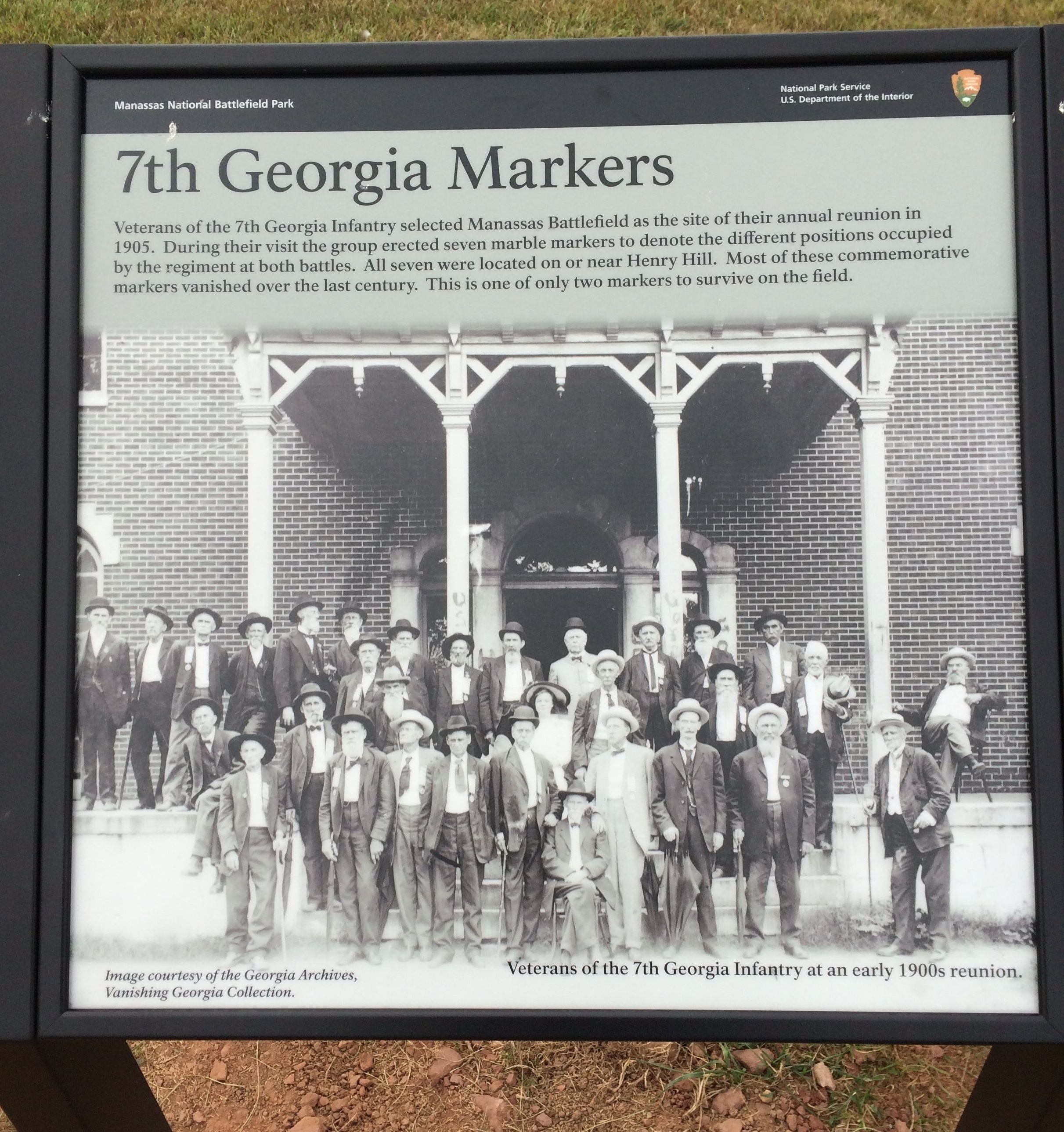
Veterans of the 7th Georgia Infantry – which was in the thick of fighting at the First Battle of Manassas (Bull Run) – in 1905 opted to place six markers indicating where they were positioned in that battle and another marker for a position at Second Manassas in August 1862.

The markers fell victim to time and vandals, with only two still on the field today, one of them rarely seen by visitors.

Officials believe this returned so-called “second position” marker disappeared before the park was established in 1940. How the top half landed in the upscale Langley neighborhood of McLean – near the CIA headquarters – remains a mystery. The son of the school’s director in the 1970s found it while doing construction work on an old barn on the school property. His mother believed it to be a tombstone for a Georgia boy.

A sketch of the barn on the school property (Courtesy of McCormick family)
That wasn’t the case, says Manassas National Battlefield Park museum specialist Jim Burgess, who has documented the 7th Georgia position markers and tried to get this one donated to the park nearly 30 years ago after he learned of its discovery.

The school’s director held onto the marker and Burgess moved on to other things. After the director died in 2018, her children sold her home to the school and left the artifact behind.

In February, the federal park got a call from the school, indicating the school’s desire to see the stone back at Manassas. Burgess got to the campus within two hours. 

“It has sort of been on the back burner,” Burgess said. “I was flabbergasted in getting the call.”

Sign at Manassas park has photo of 7th Georgia veterans (Shane Oliver/HMdb.org)
The fragment is about 10 inches by 10 inches and appears to have the first part of  “2nd POSITION” etched at top.

The park has put the piece in a temporary display case along with a photo of an outdoor stone fireplace/grill – a seemingly odd pairing.

Burgess believes the lower half of the marker may be the gray stone in the middle of the fireplace, which was built by a farmer on what is now park property.

Georgia veterans returned to battlefield

The 7th Georgia, part of a brigade led at Manassas by Col. Francis S. Bartow, was mustered into Confederate service in late May 1861. Most of the regiment’s soldiers were from Coweta, Paulding, DeKalb, Franklin, Fulton, Heard and Cobb counties in northern Georgia.

The unit was rushed to Virginia and saw heavy combat at Manassas on July 21, 1861, the first major battle in the Eastern Theater. (At left, photo of Pvt. John William Barrett of the 7th)

Bartow was killed while leading the 7th against Capt. James B. Ricketts’ battery on Henry Hill during a pivotal moment in the fighting, which swung to the Confederates’ favor late in the day for a victory that left Union forces fleeing to Washington. The 7th Georgia suffered a staggering 153 casualties out of 580 men present, according to American Battlefield Trust.

Decades later, 7th Georgia veterans decided to place the position markers, rather than a large single monument. They resembled tombstones and were scattered across the rolling hills.

Burgess’ records indicate the second position marker may have been broken and displaced when the Warrenton Turnpike was widened in the 1920s.

The top half ended up in McLean, while the bottom -- which has no inscription -- may be in the fireplace adjacent to the old George Sutton farm.

Piece of marble is in middle of large fireplace at Manassas. (Jim Burgess, MBNP) 
In 1970, Sutton said he built the fireplace with stones recovered from the area, but “This piece of marble here was picked up along the highway when we put the fence up there. Evidently it was a piece of a monument…”

The farm was acquired by the park in the 1950s.

Fragment was found among rocks

In the 1960s, Dorothy McCormick, a leader in early childhood education, started a small school at her Great Falls, Va., home. McCormick (right) later acquired Happy Hill School (renamed The Country Day School) in McLean in the early 1970s. 

The nonprofit venue, located in the suburban Washington, D.C, neighborhood, offers preschool and kindergarten classes. McCormick promoted motor skills training and an enrichment center, among other innovations.

“We called her the director. She was old school,” said son Robert McCormick. “Very sweet, but you didn’t give her any guff.”

Becky Benton, current officer coordinator at the private school, told the Picket that Mrs. McCormick, a widowed mother of six children, had a strong imprint on staff and parents.

“She had a way of attracting people to her mission,” Benton said.

The 5-acre property included a two-story cattle barn built in 1921.

Mrs. McCormick decided to live there after extensive renovations were made. Robert, who designs and builds homes, led that project. In 1977, he discovered the marker while moving rubble and other material from a fill pit while working on a deck foundation at the barn.

“It was in there. We had thought we had uncovered a Civil War grave site,” he said.

“She was very excited to think a soldier may have been buried here,” Benton said.

McCormick’s mother kept the fragment on the hearth as a conversation piece, and a 1990s Washington Post article about Langley includes a photograph of her holding the stone, described as a tombstone.

Mrs. McCormick told the paper it was an indication of the area’s historical significance.

“It was important for her to keep it safe,” Benton said. “She was history minded and appreciated the history of the school and America.”

Park communicated with educator 

After reading the article, Burgess contacted Dorothy McCormick by phone and through a March 1994 letter, sharing what he knew about the position markers and telling her the fragment was not a tombstone.

We did not know as much about the movements of the 7th Georgia Regiment and their markers at that time (of the letter) as we do today,” he told the Picket earlier this year.

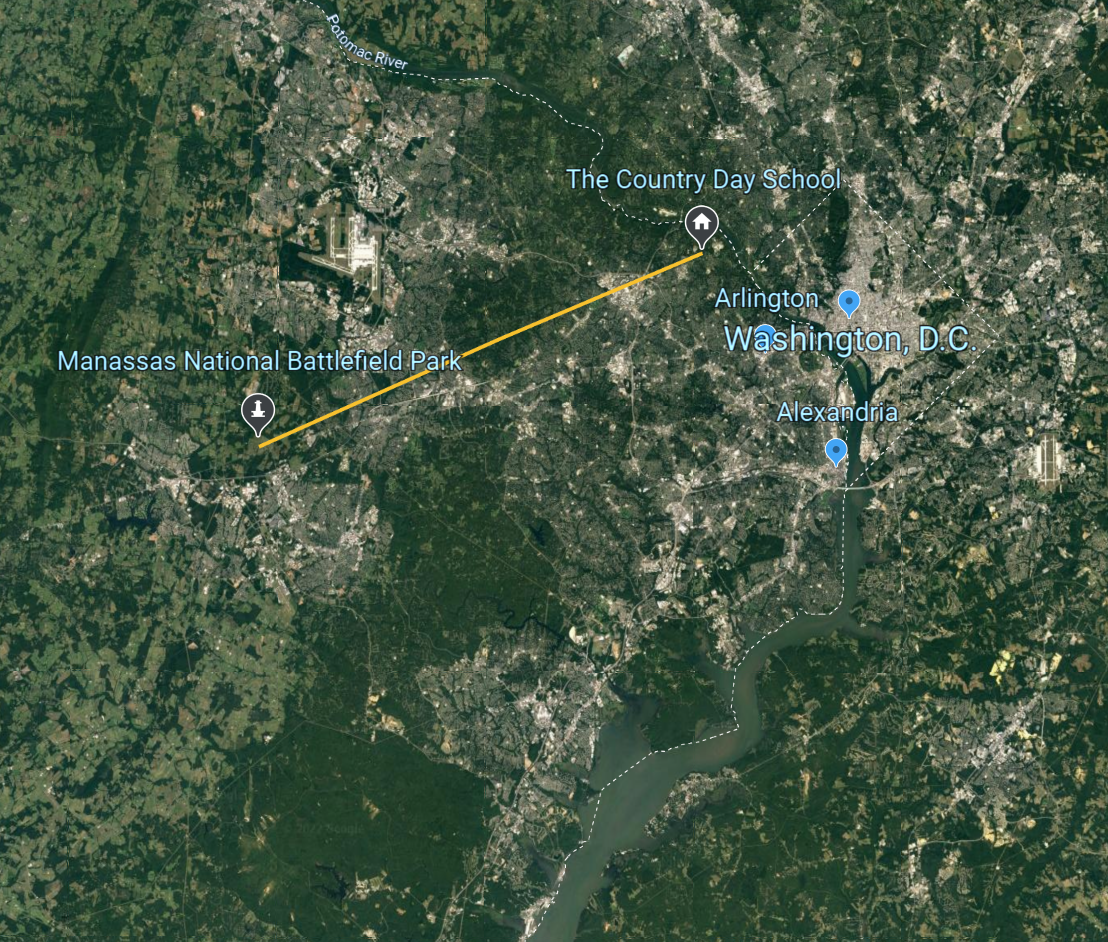
The school is in the Washington, D.C, area (Andrew Gast map, click to enlarge)
The official asked Mrs. McCormick to look at documentation of the markers. “Naturally, we feel the stone in your possession rightfully belongs at the battlefield. We would be most grateful to accept it as a donation to the park’s museum collection should you feel inclined to part with it,” Burgess wrote in 1994. (McLean is about 25 miles from Manassas.)

Burgess said after the letter was sent, the school director “indicated to us by phone that she wanted to retain it for sentimental reasons, I guess. We did not pursue it. We did not have any legal claim to it because it disappeared well before the park was established.”

The letter probably annoyed his mother, said Robert McCormick, and she likely forgot about it over the years, he said.

Dorothy McCormick sold the school and a cottage on the property in 1991 and continued living in the converted barn until her 2018 death at age 96. The family then sold the barn to The Country Day School, which in turn converted it into an office.

Robert McCormick says his mother was very happy while living in the rustic barn. “It was a cozy, homey place.”

Chance review of photos led to donation

The Country Day School and the surrounding neighborhood is rich with history. The main building was constructed in 1858 and at times it served as a church, Civil War hospital and residence. Mrs. McCormick lived in a cottage on the property before moving to the barn.

Converted barn and main building of The Country Day School in McLean (Picket photos)
After the McCormick family sold the old barn, they left school-related items, photos and the marker in the structure.

Early this year, Benton – the office coordinator – went to the structure to find old photographs of the main building for a class of children who are age 3.

She flipped through a photo album and came across the 1994 letter from Burgess. While Benton knew the marker was there, she had not seen the correspondence. “(Mrs. McCormick) did not necessarily agree it was not a soldier’s gravestone.”

“It was very sentimental for Mrs. McCormick. The children thought it belonged here. We felt it belonged to the battlefield.” The school decided to make the donation and reached out to the park.

Robert McCormick was not aware of the donation until reached by the Picket, but he says the family is satisfied with the disposition.

The two 7th Georgia markers still on the field (Manassas National Battlefield Park)
Burgess said he is pleased the marker is back “home.” He would like to see it displayed with a piece of another position marker and a map.

The stone fragment we just acquired lacks sufficient integrity to be put back in the ground.  It would be nice to replace all seven markers with exact reproductions and save the originals in the park collection,” Burgess wrote in an email.

The originals have been subject to damage from tree falls, road construction, vandalism and theft. It would be good to protect what is left of them and still mark the positions the veterans made effort to preserve for posterity. Unfortunately, we don't have the funding to do that.”

Burgess set up this display after the school's donation (Jim Burgess, MNBP)