Showing posts with label visitor center. Show all posts

Monday, October 28, 2024

North Carolina's Fort Fisher will reopen Wednesday after six-month closure for completion of new visitor center, notable rebuilding of earthworks section

A gun emplacement is ready for a replica 32-pounder to be installed (all photos Fort Fisher SHS)
Drier weather in the past month – following damaging rainfall in mid-September – allowed construction crews to complete recreated earthworks ready for the reopening of Fort Fisher State Historic Site near Kure Beach, N.C, this Wednesday.

The Civil War site’s new two-story visitor center and the earthworks will open at 9 a.m. Guided tours will be held throughout the day. Patrons will be able to walk up new replica gun emplacements

The site closed in April to allow completion of the visitor center and the recreation of three traverses, bombproofs, a magazine and the sally port. Fort Fisher’s use during World War II helped the Allied cause but destroyed some of its familiar defensive traverses. They were removed to make way for an airstrip when the area was used for training anti-aircraft and coastal artillery units.

Last month, about 18 inches of rain created a cascade of mud at the earthworks site, delaying the site's opening by several weeks.

Rifled and banded pieces are put in place in view of the new visitor center
Everything is complete except one artillery emplacement, said assistant site manager Chad Jefferds.

“Once things dried out enough, (crews)  had to go about getting the dirt that had washed down back onto the mound. This allowed for the carpenters to construct the gun emplacements. It was impressive how quickly they finished everything in light of where things were immediately after the storm,” he said.

Bordeaux Construction of Morrisville, N.C, was the main contractor. The company's Facebook page last week had this account of the placing of artillery.

“The cannon installation was very smooth; it only took around 30 minutes – but it required a 125’ crane with roughly 6,000 lbs of counterweight to be able to get it into location. The carriage had to sit on a 'pintle block' (a concrete column with a cast iron pin about 2” wide on top. There was a hole for this pin under the carriage that was the same size. This took some precise positioning, but we were able to set it (in) one smooth motion.”

Fort Fisher was built on the peninsula between the Cape Fear River and the Atlantic Ocean, south of Wilmington. It is best known as a crucial coastal bastion for the Confederacy.

On Jan. 15, 1865, after a naval bombardment, the Federal army attacked from the western, river side while Marines pushed in from the northeast bastion.

Essentially everything between Shepherd’s Battery on the western end of the fort’s land face and the center sally port were the scenes of intense fighting during the US Army’s assault.

The three new traverses, as with the original six, were the scenes of heavy, close-quarters combat as Union troops pushed east.

The fall of the "Gibraltar of the South" cut off blockade runners and the last supply line through Wilmington to Robert E. Lee’s Army of Northern Virginia.

The new visitor center stands about 100 yards from the fort wall. It is just north of the east-west line mounds of earth known as traverses. Much of the eastern part of the fort has been claimed by the ocean. 

There is no admission charge for visiting Fort Fisher, but donations are accepted..


Regarding the visitor center, “New sections covering the time before Fort Fisher as well as the span of time between the Civil War and WWII are where we had to bring in the most new artifacts,” Jefferds told the Picket.

“The story is the same and Fort Fisher is obviously the central theme, but the way it’s told is different. We’ve tried to tell the story of Fort Fisher through the eyes of the people who lived, worked, fought and died here.”

The next big event on the site's calendar is the 160th battle anniversary on Jan. 18, 2025. Interpreters will be stationed in the new earthworks.

In case you are wondering whether the weather will again play high jinks for the opening: The forecast for Wednesday calls for partly cloudy skies in the Wilmington area.

Thursday, September 12, 2024

The new Fort Fisher visitor center, opening Sept. 27, will tell a wider story. Crews at the North Carolina Civil War site are rushing to finish recreated earthworks

New visitor center, Civil War map along staircase to the second floor and a colorized version of a Timothy O'Sullivan photograph of a damaged Fort Fisher traverse (FFSHS)
(Editor's note: The park announced Sept. 20 the opening is indefinitely postponed due to flooding damage from a tropical system)

A new and larger visitor center at Fort Fisher below Wilmington, N.C., will provide a broader and more people-centric history than the previous venue, officials said.

The state historic site near Kure Beach recently announced the two-story visitor center and its museum will open on Sept. 27. The park closed in April for construction of the 20,000-square-foot visitor center and for an usual rebuilding of earthworks.

“There are a few more items in the Civil War section, but the new sections covering the time before Fort Fisher as well as the span of time between the Civil War and WWII are where we had to bring in the most new artifacts,” assistant site manager Chad Jefferds told the Picket.

Fort Fisher was built on the peninsula between the Cape Fear River and the Atlantic Ocean, south of Wilmington. It is best known as a crucial coastal bastion for the Confederacy.

A Whitworth gun on the first floor of the visitor center (FFSHS)
On Jan. 15, 1865, after a naval bombardment, the Federal army attacked from the western, river side while Marines pushed in from the northeast bastion. The fall of the Gibraltar of the Southcut off blockade runners and the last supply line through Wilmington to Robert E. Lee’s Army of Northern Virginia. U.S. Colored Troops were among those taking part in the attack.

Essentially everything between Shepherd’s Battery on the western end of the fort’s land face and the center sally port were the scenes of intense fighting during the US Army’s assault. The fighting went from along the traverses from west to east and was often hand-to-hand.

Fort Fisher’s use during World War II helped the Allied cause but destroyed some of its familiar defensive traverses. They were removed to make way for an airstrip when the area was used for training anti-aircraft and coastal artillery units.

Construction crews are working to complete recreations of three traverses, bombproofs, a magazine and the sally port, Jefferds said. “The dirt being brought in has to dry out to a certain level before it can be used, but the weather has not been conducive. Hopefully it will be ready for our grand opening, but it’s no guarantee at this point.”

Sally port tunnel on far left during traverse reconstruction. At far right is historic traverse (FFSHS)
With the three traverses will come two gun emplacements, which will each have a heavy cannon, along with two 12-pounder Napoleons in the center sally port.

The new visitor center stands about 100 yards from the fort wall. It is just north of the east-west line mounds of earth known as traverses that were part of the defenses. Much of the eastern part of the fort has been claimed by the ocean. 

“Not only will visitors be able to see the majority of the remaining traverses from the second floor, they will also be able to see them as they approach from the parking lot. This is one of the main reasons for the first floor being perpendicular to the second floor,” said Jefferds.(bombproof recreation, below)

The visitor center’s first floor has a welcome desk, gift shop, restrooms and staff offices.

The second floor houses the main exhibit gallery as well as a temporary exhibit gallery that will change regularly. It  is home to an information desk, an orientation theater, restrooms and a multipurpose room that can be used for a classroom space, banquets or wedding receptions.

Among the wall displays is a colorized Timothy O’Sullivan photo of the fort taken shortly after its fall.

That particular photo is of the 4th traverse along the land face of the fort, likely where the fort’s commander Col. William Lamb was wounded,” said Jefferds. “It really shows the carnage that abounded here after the U.S. Navy’s bombardment and ensuing land battle, with the broken cannons and debris scattered all around.”

I asked him whether the venue will tell the same story, with some twists.

“The story is the same and Fort Fisher is obviously the central theme, but the way it’s told is different. We’ve tried to tell the story of Fort Fisher through the eyes of the people who lived, worked, fought and died here. We’ve also enhanced the coverage of the time before the Civil War as well as the time after, all the way through WWII when the fort served as a training facility for antiaircraft and coastal artillery units.”

Parking and admission at the site is free. Hours are 9 a.m.-5 p.m. Tuesday-Saturday. The building is wheelchair-accessible and an elevator goes to the second floor.

Wednesday, May 22, 2024

Pvt. Christopher Fritz was a tip of the spear clearing roads during the Atlanta Campaign. At Kennesaw Mountain, a descendant is paying tribute this week

John Fritz describe weapons during a  talk May 22 at Kennesaw Mountain (NPS photo)
John Fritz’s great-great-grandfather, Christopher, toted a rifle and a whole lot more during his service in the 105th Illinois Volunteer Infantry -- namely, axes, hatchets, files, saws and augers.

Pvt. Fritz was likely picked for an Army of the Cumberland XX Corps detachment known as pioneers because he was a carpenter and dependable. During the Atlanta Campaign, the acting engineers followed Union skirmishers and made sure roads and bridges were in place or passable for the main army, among other duties.

They were, in essence, tips of the spear.

John Fritz, a reenactor from Chandler, Ariz., this week is making short presentations about Federal infantry weapons at Kennesaw Mountain National Battlefield Park near Atlanta. He has a pioneer chevron on his uniform sleeve as a tribute to his ancestor, who fought in many campaigns, including in June 1864 at Kolb’s Farm near Kennesaw Mountain.

“Those guys had their work cut out from them,” the electronic engineer told me over the phone, without first realizing the pun. “They were responsible for going ahead and clearing the roads and muddy creek crossings.”

Fritz, 61, will give talks at 1:30 p.m. Thursday and Friday near the park visitor center. (Photo left, National Park Service)

Fritz has volunteered at the park for the last 10 years during visits to Georgia to attend events. He just attended a reenactment in Resaca, Ga. (where the 105th Illinois fought), and will attend an anniversary event Saturday at the Pickett’s Mill battlefield west of Kennesaw Mountain.

Fritz wanders the Kennesaw Mountain battlefield and talks with visitors about the life of an infantrymen and specifically his ancestor, who fought in North Georgia and at Peachtree Creek in Atlanta. “I feel people like to hear that connection.”

This week, he has set up a table displaying four guns the Federal army used.

The reenactor did not know of his great-great-grandfather’s service until his father died in 2011. “The family didn’t say anything about it, even my grandparents,” John Fritz told the Picket.

His father, Dale, was from Elgin, Illinois, and the family moved to Southern California when John was young.

He has since learned that Christopher Fritz, a native of Germany, enlisted early in the war while in his early 30s. He served in the 105th's Company G.

“I basically followed his whole route, pretty much traced his footsteps from Belvidere, Illinois, to Washington, DC,” where Christopher mustered out in June 1865, two weeks after the Grand Review of the Armies.

The soldier lost a thumb to gunfire while on guard duty for several months at Fort Negley in Nashville. The incident apparently was accidental, John Fritz says. Christopher received a pension about 15 years after the war

The veteran had a family in Belvidere and died in August 1903 at age 73. John helped arrange for a new Veterans Administration headstone to be placed at the grave.(Photo courtesy of John Fritz)

John is a member of the Scottsdale Civil War Roundtable in Arizona. He has been to several battlefields where the 105th Illinois fought, including a couple in North Carolina.

“I just really got interested in learning about my ancestor and it turned into a project to honor him, learn more about him. I enjoy traveling. I had never been to the South.” 

Wednesday, May 17, 2023

Civil War-themed painting gifted to Kennesaw Mountain was made by a 'hidden' artist. Now Doug Brooks' creations are reaching the world

Douglas L. Brooks created this in the final year of his life, click to enlarge (KMNB)
After 10 years living on a wooded lake cove in Alabama, artist Douglas Lee Brooks returned home to Georgia and his childhood memories.

The first work the painter produced back in Cobb County, northwest of Atlanta, was a scene from the Civil War -- soldiers and horsemen clashing in a sea of color. The war was a subject dear to Brooks, who grew up in a neighborhood near Kennesaw Mountain National Battlefield Park.

“Behind our home there was no development and the back face of Kennesaw Mountain,” says his sister Dolly Brooks. “You can imagine my brothers crossed the creek and through the woods. The back of Kennesaw Mountain was their playground.”

The powerful painting – full of light and vibrancy and exuding a childlike freedom – was donated in March to the park, 15 months after Brooks, 68, died of esophageal cancer.

The untitled work is among the last of about 1,500 paintings that Doug Brooks produced. His sister calls him a “hidden” artist, a private and contemplative person who never sold any of his creations, rather giving them to family and friends.

Painting at Rhode Island preschool (Courtesy of Douglas L. Brooks Collection)
Dolly Brooks, of Providence, R.I., lived near her brother in Marietta during the final year of his life. “When he knew he was dying, and asked me if I would accept his collection, he said, ‘You will know what to do.” 

As caretaker of 1,200 paintings, Dolly is now thoughtfully gifting them to places that reflect the causes her older brother supported, among them arts education, scholarships and organizations fighting food insecurity. Most of the works depict Southern life and culture – from street preachers and gamblers to farmers and people playing music and dancing.

Dolly approached Kennesaw Mountain National Battlefield Park in January about donating the large acrylic and canvas painting.

“I knew there was only one place I wanted the painting to be,” Dolly told the Picket. “You have to stand before it. To see it on your screen is nothing like standing before it.”

The artist made hundreds of Southern scenes (Courtesy of the Douglas L. Brooks Collection)

'Like dancing on the canvas'

The Brooks family has a real connection to the June 1864 Kennesaw battlefield. Doug and Dolly’s grandfather, Forrest, was born at Kolb Farm, scene of intense fighting. The National Park Service acquired the property years ago.

The Marietta home where the siblings grew up, St. John’s Court, blends into the woods.

Doug had a deep reverence for nature – the seasons, colors and animals – but he also had an appreciation for history, and he would often visit the Civil War park, taking in the movie and exhibits.

So it is no surprise that the artist recreated his childhood memories in the painting. Kennesaw acknowledged the gift in a Facebook post, saying the park was “always a treasured space to him.”

Forrest Clinton Brooks, born at Kolb's Farm (Courtesy of Dolly Brooks)
Park ranger Amanda Corman told the Picket the painting hangs in the visitor center vestibule.

When asked to describe the scene, Corman replied, “I cannot say that the painting depicts a specific portion of the battle; however, it is to reflect on the fighting that did take place at this location.” 

Doug moved to larger canvases later in life. While continuing use of oils on canvas, the painter began to do more with acrylics.

“I really like the large format. It’s like dancing on the canvas,” says Dolly, 67, of the painting now at the park. “He loved to play with the color and brush strokes (that) he could do.”

“It probably took him a week. “When it had the magic, he would take it off the easel.”

“The Confederate flag is muted,” she said. ““I love the horses that are coming in from the canvas on both sides. The more you look at it, the more you see.”

Tri-set depicting Civil War combat, click to enlarge (Courtesy of Douglas L. Brooks Collection)
Her brother was only able to make four paintings after returning to Georgia. “Doug often would paint through the night, if he was so inspired.”

The artist produced 15 or fewer paintings with a Civil War theme over his lifetime.

Dolly said she is touch with Corman about possibly gifting a smaller tri-set he made in the late 1980s for the park’s educational classroom.

He believed in coloring outside the lines

As collection caretaker, Dolly says her mission and charge is to bring her brother’s work to the public, and the Kennesaw Mountain gift is among the first on exhibit.

The retired teacher recently gifted two early works to the Georgia Museum of Art at the University of Georgia. (Self-portrait by Doug at left is courtesy of the Douglas L. Brooks Collection. He was about 34 at the time.)

A larger canvas is now hanging at Imagine Preschool at the Providence Center in Rhode Island. A sign near the colorful painting of a fish – made by her brother in Alabama -- says, “May children always be encouraged to color outside the lines.” (Painting is second in this post)

Doug was not a professional artist, though he took lessons as a child from local artist Forrest Jacobs. He attended the University of Georgia from 1971-1972 and was in the art program led by Lamar Dodd. The student didn’t like the environment or academics, so he left. Later, after a stint in the U.S. Navy, he worked in the family business in Cobb County.

But the bachelor’s real passion was art, and Doug also produced drawings, pottery, plates and writings over 50 years. Dolly says viewers can appreciate a Southern and regional touch in the paintings, from sharecropper shacks to fishermen and night scenes. Many are joyful and playful, she says.

Dolly describes Doug as her best friend, a deeply spiritual man who believed strongly in storytelling. About 150 of the paintings are self-portraits, the first when Doug was 29 and the last from 2020. “I believe he knew he was not well.”

A Southern scene made by the artist (Courtesy of the Douglas L. Brooks collection)
Doug did not want anyone to profit from his work and his sister is not selling it at this time. Instead, Dolly says she is making gifts of his art that will be, as her brother said, flowers for walls.

“I look at his work and I just recognize the beauty of him," Dolly says. “His art will be seen by the world as he requested.”

Monday, April 17, 2023

Gettysburg unveils bronze markers that feature braille, 3D landscapes. The idea came from a giant map that has aided park guides for generations.

New tactile marker at Virginia Memorial includes braille (click to enlarge, GNMP)
Three new Gettysburg National Military Park markers – featuring landscape elevations that visitors are encouraged to touch – were inspired by a massive topographic map created more than a century ago and on display at the park’s visitor center.

Park officials on Friday said two bronze relief tactile tables have been installed at key tour spots and another is on the way. The three-dimensional tables feature braille and raised lettering, making them the first such additions to the park.

“Visitors will now have access to better understand the landscape across which the battle was fought and how terrain influenced the movements of the two armies at Gettysburg in July of 1863,” the park said in a news release.

One table is on the plaza at the Virginia Memorial (Auto Tour Spot 5, photo at left) and other at the National Cemetery parking lot (Auto Tour Spot 16). Another is coming soon to the Eternal Light Peace Memorial (Auto Tour Spot 2).

Gettysburg spokesman Jason Martz told the Picket in an email that visitors who are visually impaired can read them by touching the table and its key. “The raised lettering, along with the braille, allow those with visual impairments to gain a better appreciation for the park landscape,” he wrote.

Martz said the idea for the three tables was based on a giant relief map of the battlefield produced by Emmor B. Cope, an engineer who was at the battle and returned a few months later to help survey the ground.

Cope was instrumental in the creation of numerous battlefield monuments and features and was the park’s first superintendent.

His bronze relief map -- 12.5 feet by 9.5 feet and 4 inches deep – is considered an indispensable tool for historians of the early battlefield, according to the Gettysburg Daily website.

It was displayed at the 1904 St. Louis World’s Fair. It includes tiny buildings and avenues that were built after the war. The map created by Cope (right) was laid flat at St. Louis and at the old Cyclorama building at Gettysburg; it is now propped vertically against a wall near the bookstore at the Gettysburg visitor center.

Park ranger Troy Harman, in a 2021 video posted on Facebook, explained why he considers the incredibly detailed Cope map to be the most important artifact at Gettysburg.

“It has always fascinated me and I have relied on it heavily in doing programs on the battlefield because it is so meticulous in its design and its precision of the Gettysburg battlefield.”

Since the Cope map caught a moment in time – when Cope and others surveyed the battlefield soon after the battle -- historians and others can turn to it to see what the area looked like before development and park features altered the landscape.

The behemoth Cope relief map in the visitor center (GNMP)
“If you want to see what the ground was originally like, come back to this map,” Harman said. “The ground is pristine, as it looked like at the time of the battle.”

Speaking of the much smaller tactile tables, Martz told the Picket the elevations were taken from existing GIS maps and further refined by utilizing historical information from the Cope map and others made by those working for Maj. Gen. Gouverneur Warren, chief engineer for the Army of the Potomac.

The three tables were created by Pannier Graphics and cast at an American Bronze foundry.

The creation of the tactile tables is part of a larger project to update interpretive signage throughout the park, officials said.

New tactile table in parking area of Gettysburg national cemetery (GNMP)

Sunday, May 30, 2021

Wilson's Creek battlefield: Bed that held Gen. Lyon's body and multimedia kiosks among the highlights of renovated museum

Exhibit details action by the Pulaski Light Artillery Battle (NPS photo)
The bed on which the body of Union Brig. Gen. Nathaniel Lyon (left) was laid is the centerpiece of the newly renovated visitor center and museum at Wilson’s Creek National Battlefield in southwest Missouri.

Officials last week unveiled the $3.5 million renovation project, which expands exhibit space by about 1,800 feet, park Superintendent Sarah Cunningham told the Picket in an email. The work was supported by Wilson’s Creek National Battlefield Foundation and the National Park Foundation.

“The new exhibits will highlight more of the park’s collection Civil War artifacts as well as new audio-visual exhibits. This makes it possible for people to view historic weapons demonstrations and digitally view fragile artifacts and other items in storage,” she said of kiosks and other features. 

The Battle of Wilson's Creek on Aug. 10, 1861 -- the second major battle of the war -- resulted in a Confederate victory after its forces made multiple assaults on Union lines. Federal troops retreated to Springfield. 

Though victorious on the field, the Southerners were not able to pursue the Union forces. Lyon lost the battle and his life, but he achieved his goal: Missouri remained largely under Union control.

Visitors will see approximately 90 percent of all edged weapons and firearms from the park’s museum collection and will learn the history of 19th-century firearms technology and how it affected the outcome of the war, Cunningham said.

(Morphy Auctions)
A featured firearm is a rare Model 1860 Henry repeating rifle (above), recently donated to the park by the Wilson’s Creek National Battlefield Foundation. While the weapon was made in 1864 and has no connection to the fighting at Wilson’s Creek, the rifle belonged to George Fulton, a Missouri veteran of the Trans-Mississippi Theater of the Civil War. The Henry was among the most technologically advanced weapons of the conflict.

Cunningham said the park will be able to display additional items from the collection of Trans-Mississippi Theater artifacts purchased from Dr. Thomas Sweeney in 2005.  

The original “Lyon bed" (below) belonging to the John Ray family previously was displayed at the historic Ray House. Park officials wanted to feature the artifact and secure its future in the climate-controlled museum. A reproduction bed is now visible in the Ray House.  

While the Ray House was not hit by fire, it was in the thick of the fighting during the battle.

The Lyon bed in park museum. (National Park Service photo)
“As soon as the battle ended, the family emerged from the cellar to find their farm house was now a hospital, and immediately began to assist medical personnel in treating the wounded and dying,” the park says on its web site.

“The children made many trips to secure water from the springhouse for the suffering soldiers. Later, the body of General Nathaniel Lyon was brought to the house and examined before it was removed to Springfield under a flag of truce. Roxanna (John Ray’s wife) supplied a counterpane, or bedspread, to cover the body. While most of the wounded were quickly removed to Springfield, one soldier would convalesce with the Rays for several weeks before he could be moved. In addition, most of the family's livestock and crops were gone, foraged by hungry soldiers.

The visitor center before (top) and after the renovation (NPS photo)
According to the Aurora Advertiser newspaper, two new exhibits showcase the loading and firing of artillery and their transportation. Other cases included possessions of civilians caught up in the fighting.

An exhibit focuses on the Confederate Pulaski Light Artillery Battery. The Arkansas unit engaged in a furious exchange with a Federal battery at Wilson’s Creek, and it checked Lyon’s advance.

A 2018 article in Emerging Civil details the battery's trial by fire and the acclaim it received for helping turn the tide of the battle.

Artillery piece and limber in the foreground (NPS photo)

Sunday, March 31, 2019

Wilson's Creek visitor center to expand

A $4.5 million project will make room for more Civil War-era artifacts at the site of the first major battle west of the Mississippi River. The project will add 1,873 square feet of exhibit space to the visitor center at the Wilson’s Creek National Battlefield in southwest Missouri. There were an estimated 1,200 Union and 1,100 Confederate casualties at the site in August 1861. Fundraising got a major boost last week when Bass Pro Shops donated $25,000 to help jump-start a $300,000 local campaign, the Springfield News-Leader reported. • Article

Thursday, April 12, 2018

Fort C.F. Smith in Arlington was among 68 that kept Lincoln's Washington safe; park's new visitor center tells the story of these defenders

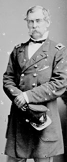
Men of the 2nd New York Artillery (Library of Congress)
New visitor center at Fort C.F. Smith Park (Arlington Co. Parks)
The boys of the 164th Ohio Volunteer Infantry were quite pleased with their new post after they completed a journey that took them from Cleveland to Washington, D.C.

Upon arrival, they marched down dusty capital roads, across the Potomac River and onto the ridges and ravines of Arlington Heights, on the Virginia side. There, they joined the garrison of Fort C.F. Smith, the last in a string of defensive fortifications that stretched southeast toward occupied Alexandria.

The troops could feast on luscious blackberries in the thickets (though the grounds had been denuded of trees so that the artillery would have a clear line of fire), or saunter down to the Potomac River, less than a mile away, to harvest tasty fish and eels.

“We have a most splendid location, at an elevation of two hundred feet above the Potomac river; overlooking the country in every direction,” a soldier wrote on May 21, 1864, to the Tiffin Weekly Tribune (left) back home. “Off to the east, in full view, is the city of Washington, and the capitol of our nation; to the south lies Fort Strong; in the west the Potomac winds its way through the hills, and in the distance may be seen Ft. Ethan Allen; to the north a beautiful array of hills, with splendid residences dotting them here and there.”

That sense of relative calm and comfort was common for thousands of artillerymen and infantry who occupied 68 enclosed forts encircling the capital. Twenty-two of them were in Alexandria (now Arlington) County.

None in the county saw action, but there was always the threat of a Confederate rush on the capital, which occurred in July 1864, sending the city into panic. That effort was rebuffed at Fort Stevens in Maryland, on the northern outskirts of Washington.

Fortification remnants at C.F. Smith (Arlington Co. Parks)
Earthwork remnants in the 19-acre Fort C.F. Smith Park are considered the best preserved of those 22 Arlington-area forts. While most traces are gone, the ruins of the lunette fort include a bomb proof, the fort well, the north magazine and 11 of the 22 gun emplacements.

Visitor center tells story of these sentinels

Arlington County park officials late last month opened a new visitor center at the site. Inside are artifacts, photos, a searchable database for soldiers stationed at the fort and items geared for children, including a tent and uniforms they can try on.

While the park draws birders, walkers and others interested in a meadow and generous tree canopy, officials want people in the county to know more about its Civil War past. For a long time, that was limited to Arlington House, also known as the Custis-Lee Mansion, said John McNair, acting park historian at Fort C.F. Smith.

 “Our goal is to … stir excitement in the local Arlington community for the Civil War history in their back yard,” said McNair.

 C.F. Smith and other forts (click to enlarge; Library of Congress)
The perimeter forts were abandoned in 1865 at war’s end. A few remnants exist, including at the county’s Fort Ethan Allen Park, which was located to the northwest of Fort C.F. Smith. Today, the site has a nearby county dog park.

A 1994 Washington Post article about the purchase of land for Fort C.F. Smith Park cited Civil War historians who said the capital's series of surrounding forts, trenches and cannon batteries made up a "largely forgotten legacy that literally is woven into the region's landscape."

Local counties and the National Park Service are trying to spark interest in their unheralded contributions to the war effort. After all, they kept the capital safe.

Trees were cleared and their wood used

Engineer Brig. Gen. John Gross Barnard designed and built the 68 forts, a task made much more urgent by the ignominious Union defeat at First Manassas in July 1861. Rebel troops weren’t far from the capital – in Falls Church, Va. The Union Army Balloon Corps spied on them from Fort Corcoran.

More scenes from Fort C.F. Smith (Library of Congress)
Alexandria County (which was renamed Arlington County in 1920) was largely made up of farms during the war. McNair said because the forts needed to be in cleared areas, few trees in those areas today are more than 160 years old. Barns and fences were taken down for fuel. The impact on Alexandria County residents was substantial.

Laborers cut down trees that were used for camp buildings, and the whole operation created new roads and infrastructure around the capital.

Barnard wrote: “Possession was at once taken, with little or no reference to the rights of the owners or the occupants of the lands -- the stern law of ‘military necessity’ and the magnitude of the public interests involved in the security of the nation's capital being paramount to every other consideration.”

Gen. Robert E. Lee’s victory at Second Manassas in 1862 brought renewed concerns.

“Fortifications suddenly grew stronger thanks to soldier and contract labor,” fort expert B. Franklin Cooling wrote in a feature article for the Civil War Trust. “A free black landowner watched her house crumble beneath soldier axes and sledgehammers as Fort Massachusetts was expanded and became Fort Stevens.”

About 20,000 soldiers were required to adequately man these forts. Generals who likely would have wanted them at the front knew that President Lincoln was consumed with protecting the city.


For some young men deployed in Virginia, it was their first experience in seeing plantations and enslaved persons.

“When soldiers enter Arlington from Washington they sometimes talk about entering the South, even the Deep South, like Arlington is like Alabama or Mississippi,” David Farner, a senior staffer with Arlington County Parks & Recreation, says in a video posted on the Fort C.F. Smith Park website.

It bristled with firepower

Fort C.F. Smith, built in early 1863, was considered to be well-designed and sophisticated, with C-shaped earthworks and protected areas for infantry.
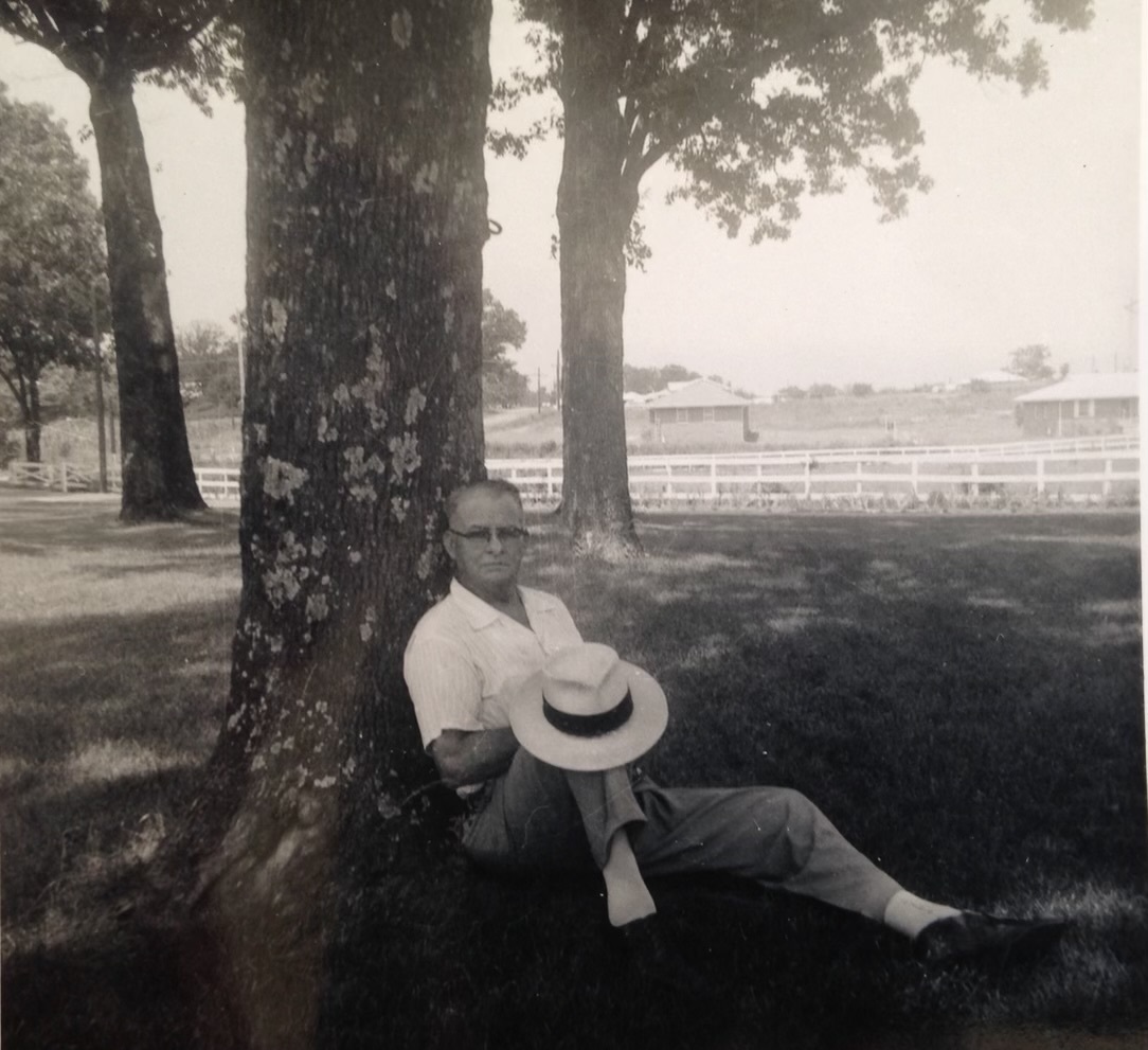
C.F. Smith
Built on land owned by Thomas Jewell, it eventually was named for Maj. Gen. Charles Ferguson Smith, a mentor of Ulysses S. Grant who later served as a subordinate. Smith died of a non-combat injury shortly after the Battle of Shiloh in April 1862.

Armament included a seacoast howitzer, 24-pounder siege guns, 12-pounder field howitzers, Rodman rifles, three siege mortars and other guns, for a total of 17 to 20 artillery pieces.

The property included barracks, officers’ quarters, a cookhouse and other buildings. Photographs kept by the Library of Congress show a pleasant camp, a haven well back from the front lines to the south. 

Between 100 and 300 might be at Fort C.F. Smith at a time. The number included heavy artillerymen, who also could be deployed as infantry.

Among the units stationed there were the 3rd Battalion, 5th New York Heavy Artillery; the 2nd New York Heavy Artillery; the 1st Rhode Island Light Artillery, Battery H; and the 30th Company of Unattached Massachusetts Heavy Artillery. The 2nd New York is the unit featured in the Library of Congress photo collection.

Fortification remnants at C.F. Smith (Arlington County Parks)

All quiet on the Potomac?

The forts on the Arlington Line, plus Ethan Allen, were built to complement each other. “One fort doesn’t need to protect everything. It can rely on other forts,” said McNair.

That’s why most of the guns in the lunette at C.F. Smith are trained to the northwest, to cover the gap between it and Ethan Allen, instead of to the south, where Confederates attackers would likely emerge. Fort Strong took care of that sector.

The elaborate Arlington Line was meant, in part, to guard the Key Bridge and Aqueduct Bridge approaches to Georgetown and Washington. While there was plenty of drilling, training and marching, there would be down time. Baseball was popular.

In late May 1864, another soldier with the 164th Ohio writes that morale is good.

“All is quiet on the Potomac. But the grand veteran army of the Potomac is not quiet.”

Searchable kiosk at park's visitor center (Arlington County Parks)
Young visitors can try on uniforms
Things certainly weren’t too quiet north of the Potomac River, just two months later. Confederate Lt. Gen. Jubal Early decided to attack the capital via Silver Spring, Md., where Fort Stevens’ guns bristled.

There was real cause for concern. The capital’s defensive fortifications had about 9,000 troops -- less half of their ideal staffing -- in the summer of 1864, because so many men had been sent to Grant’s Army of the Potomac for the push on Richmond and Petersburg. Many of those holding the fort, so to speak, were poorly trained reserves.

Reinforcements rushed to near Fort Stevens helped stem Early’s advance, on July 11 and 12, ending the only Rebel action against Washington. Some men of the 164th Ohio took part in the fighting there. President Abraham Lincoln went to Fort Stevens on July 12, and famously stood on the parapet. According to legend, young officer Oliver Wendell Holmes Jr. said, “Get down, you damn fool!”

Entrance to visitor center, more earthworks

'Quality' earthworks remain at Fort C.F. Smith

After the war ended, Fort C.F. Smith’s structures were removed and it was largely forgotten, returning to residential and agricultural use. The 107th U.S. Colored Troops for a time occupied the Arlington forts, said McNair.

Some families whose land was taken were able to get compensation for the loss of property and damage during the war. The 65-year-old Jewell testified that he lived on the property with his family until "the soldiers robbed my house and ordered me off” what became Fort C.F. Smith. 

Artifacts are on display
The property was never developed, but the construction of 24th Street on Fort C.F. Smith’s southern edge plowed through one-third of the site, and other features wore away, leaving few. Not many earthworks are left.

But some well-reserved, unrestored ones remain, and they are the focal point of a park that includes a half-mile trail near George Washington Parkway and the Spout Run Parkway.

“Our earthwork remains … considering the condition of the individual gun platforms and ramparts, I am surprised at how good a condition they are in,” McNair told the Picket. “It was a quality over quantity issue.”

The property and a house used for events and weddings was acquired from the Hendry family, which witnessed rapid growth in the area -- “the story of the agricultural community giving way to suburban homes,” said McNair.

According to the Post article, only three perimeter forts, Stevens, Foote and Ward, are restored close to their wartime appearance.

Park offers programs and tours

Fort C.F. Smith Park is nestled into an Arlington neighborhood, where homes typically sell for $1 million to $3 million.

Trail at Fort C.F. Smith Park near George Washington Parkway
Day visitors include joggers, dog walkers and students out of school. “We do have a very good, dedicated birding population out here. This is a big site in Arlington for bird watchers.”

“Our big goal is to get people more invested in the role that Arlington County played during the Civil War,” said McNair. “By and large, Arlington County residents are very passionate about their local park spaces and curious about the history they never learned otherwise.”

The county is offering history-based summer camps, school trips and guided tours of Civil War sites. “Fort C.F. Smith historic programming is going strong now and will get bigger and better with the help of the new visitor center.”

The staff is contemplating doing more on the war’s home front, including interpreting the lives of white civilians and enslaved persons.

2nd New York at Fort C.F. Smith (Library of Congress)