|
| Crew member uses ground penetrating radar (The Lamar Institute) |
With the help
of letters, diaries and homeowners who allowed excavations in their back yards,
archaeologists are beginning to fill in details of a July 4, 1864, battle that
occurred just outside Atlanta.
Analysis of November 2020 field work, including artifacts recovered at the Ruff’s Mill site, is
well underway.
Thus far, the
project, led by the Lamar Institute, a nonprofit archaeological group based in
Savannah, has been able to document Union and Confederate positions and areas
of attack and defense, trenches, possible camp areas and some boundaries of the
fighting.
The Battle of Ruff’s Mill (Nickajack Creek)
occurred in what is now the Concord Covered Bridge Historic District near
Smyrna, Ga. It was one of several brief clashes waged as Union forces under
Maj. Gen. William T. Sherman continued their relentless push on Atlanta after a
setback at Kennesaw Mountain.
 |
| Recovered bullet at Ruff's Mill site (The Lamart Institute) |
Rita Elliott, education coordinator for The
Lamar Institute, told the Picket that research has yielded much about the plan
of Federal attack. The project has located diaries and letters to and from
soldiers in Ohio, Illinois and Indiana regiments and has communicated with
descendants of men who took part in the battle. The team is trying to learn
more about Confederate units, including those from Georgia, but they have fewer
documents from which to work, she said.“What
continues to surprise me is the huge number of troops involved in the Battle of
Ruff's Mill, both on the frontal assault and those large numbers backing them
up,” Elliott wrote in an email.
“It is
mind-boggling to imagine thousands of troops marching through the small hamlets
and farms of Cobb County in 1864, attacking, defending, withdrawing and
scavenging along the way. The deafening noise of the battle; the war zones of
annihilated woods and trenched agricultural fields and pastures; the use of
isolated farmhouses and other structures as sharpshooter outposts,
headquarters, and hospitals; and the despoiling of livestock and possession
would have resulted in the Ruff's Mill community becoming an unrecognizable
area of unbelievable destruction.”
Much of the
work is being funded by the National Park Service’s American Battlefield
Protection, which awarded the Lamar Institute a $96,000 grant to document the
boundaries and features of the battle. The work has included extensive research
off-site.
The institute
applied for the grant after local homeowner Philip Ivester contacted them and
showed officials a collection of Civil War bullets and other relics he’s found
on his property over the years.
Ivester told
the Picket he assisted the Nov. 2-22 field work in neighborhoods that
dot the battleground (click GBA map at left to see July 3-4, 1864 lines).
“Not having an archaeological background, I
enjoyed learning the methodical process of the field work. There are a lot of
details in laying out a site for GPR (ground penetrating radar) work -- slow
methodical work,” Ivester wrote in an email. “It also takes a long time to
record latitude, longitude, depth, etc. for metal-detected finds but it allows
you to understand who was where and what they were shooting at to get a better
picture of Civil War battles.”
Officials have stressed the importance of the community’s
participation in the work -- by allowing access to researchers and
archaeologists. And residents and private landowners came through, providing
about one third of the acreage covered.
Elliott said 10
volunteers supplemented the work of three professional archaeologists. The
project has been supported by the Cobb County government, historical societies,
museums and volunteers.
 |
| Documenting a metal detector find |
As far as
procuring new information about the battle, the team located and documented
numerous trenches that were not recorded on Civil War maps, or had been noted
in the wrong position, Elliott said.
Charlie Crawford, president emeritus of the Georgia Battlefields Association, says Ruff’s Mill has gotten little attention because
it was a brief incident between much more notable events -- namely the Battle
of Kennesaw Mountain (June 27) several miles north and the crossing of the
Chattahoochee River by Federal forces (July 9) to the southeast.
After his
army had repulsed Sherman at Kennesaw Mountain, Confederate Gen. Joseph E.
Johnston once again had to resort to delaying tactics and a slow retreat toward
Atlanta. “Johnston occupied the Smyrna Line principally to buy time for his
wagons to retreat behind the Chattahoochee, and he did not intend to hold the
line once that was accomplished,” said Crawford.
On July 4, 1864, Brig. Gen. John Fuller’s brigade with
the 16th Corps, supported by Sweeney’s division, attacked works held
by Rebels in Hood’s command at Ruff’s Mill. “The
Southerners fell back and dug in. Union casualties in this action totaled 140
killed and wounded. Confederate losses are not reported,” writes historian and author Stephen Davis.
That night, Johnston withdrew troops to
their next position, even closer to the river.
Elliott said
the research thus far as identified dozens of regiments from Illinois, Indiana,
Ohio, Iowa, Kentucky and other states taking part in the battle.
 |
| Attack of Fuller's Ohio brigade at Ruff's Mill (Wikipedia Commons) |
The team came
across a letter from Confederate Cpl. Frank E. Blossman, of Company A, 6th
Texas Infantry in Cleburne’s division. Blossman provided a vivid account of a
Federal assault in nearby Smyrna on the same day.
“They came
with the best yell I ever heard come out of Yankee throats, and at first I
really thought they meant to interest us but when they came within a hundred
yards our boys answered with a shout of defiance. This angered the Yanks, and
the officers commenced shouting: ‘Forward, men! Forward!’ Our men answered by
shouting: ‘Come on, boys! Come on!’ Just then a Dutch officer shouted to the
Yanks, ‘Trow avay de knapsacks!’ and our men shouted not to throw them off, as
we wanted them.”
The attack
ended in a Union retreat. (Interestingly, Blossman’s letter to back home did
not reach his family until decades after the war, according to the 1899 Confederate Veteran magazine. Blossman was killed about a month after the
battle.)
Elliott told the Picket the project’s aims
include learning more about affected by the battle, including enslaved African
Americans who built defenses for the Confederate army.
 |
| Artifacts collected by Philip Ivester (Courtesy of Brian Hall Photography) |
“Our upcoming
research will examine slave schedules and later census records to try to
identify African Americans enslaved on area plantations before and during the
war, and then freedmen and women in the area following the war,” she said. “This
will contribute to our understanding of who may have been pressed into the
service of the military building defenses or in support roles. Having these
names may also help us research any records associated with them that may
actually detail their roles in the war.”
A 1904 book
indicated a man told Federal officers that he and about 1,000 other enslaved
persons had worked to construct several miles of Confederate defensives lines
outside Atlanta.
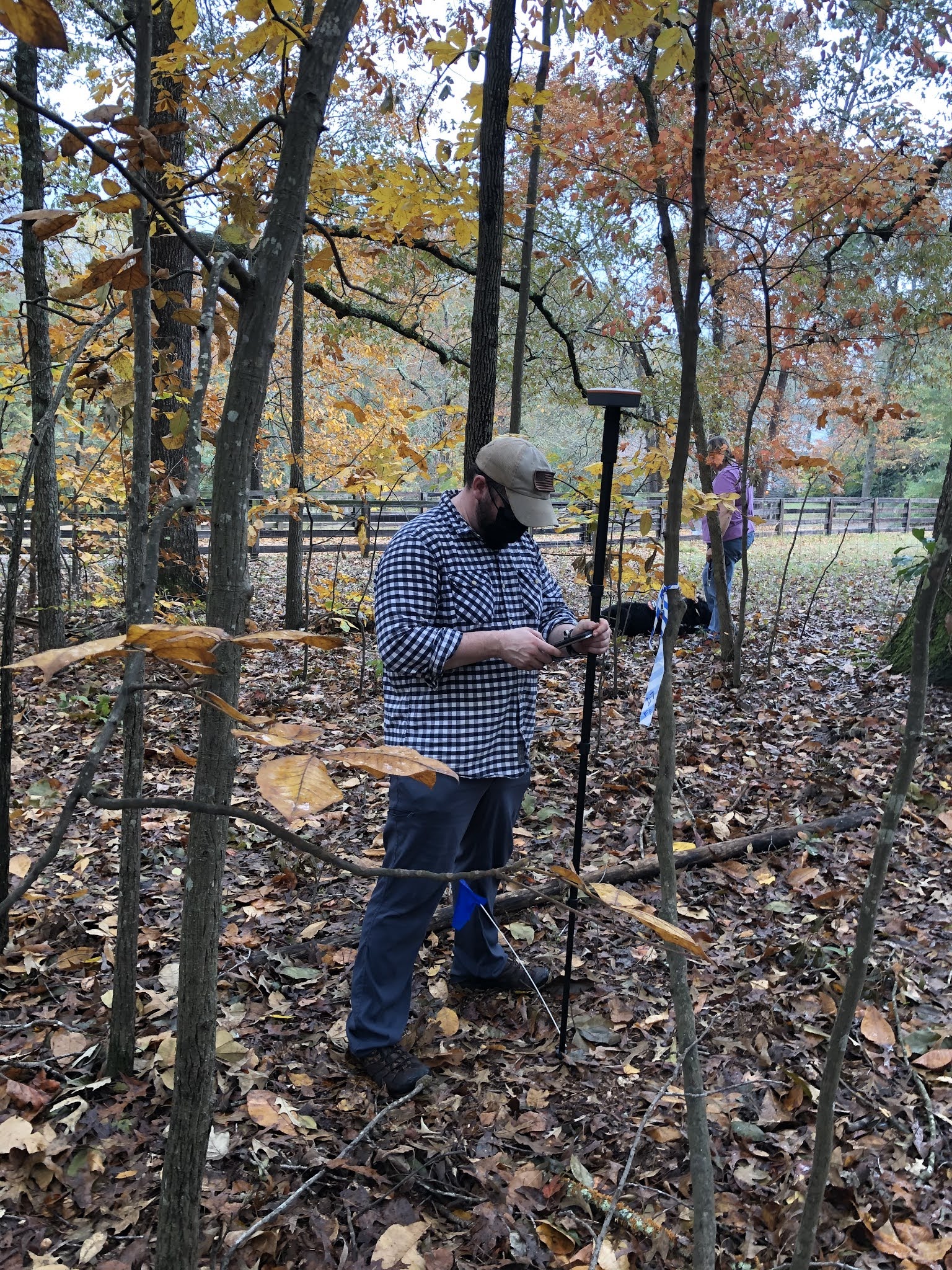
Elliott and
others on the team did conduct four GPR surveys, but most of the field work
involved metal detecting.
 |
Historic bridge on Concord Road (Courtesy of Georgia Battlefields Assn.)
|
Ivester says individuals not from the area should not do any metal
detecting; the land is either privately owned or belongs to Cobb County.The
battlefield was the scene of Rebel and Federal artillery firing, as well as
small-arms fire.
“The ... obstacle to locating the battle has been the repeated metal detecting of
the area over the past eight decades. This has removed many of the artifacts
which have been redistributed across the SE and around the world, with no exact
locations on where they were recovered or what they were,” Elliott said. “In
spite of the lower density of artifacts on these sites, we were able to
locate and document the exact positions of enough battle-related artifacts
to uncover key components of the story.”
The
archaeological team found artifacts ranging from 1 inch to 12 inches below the
surface. They are mostly bullets and artillery shell fragments. The bullets
will be studied for clues to their manufacture and which side used them.
“It is the location of
these artifacts that undeniably tell the story of the military strategy. A
limited amount of other arms and personal items were documented that help put a
human face on the battle, such as a button, a pocket watch cover, an entrenching
shovel,” Elliott said.
Analysis will
enable the institute to create maps showing where every artifact was recovered,
identifying Confederate and Union locations. “These maps can be compared with
historic maps of the battle and used to corroborate, expand, or change the
historical narrative, depending on what they tell us.”
 |
| Recording finds from metal detector survey (The Lamar Institute) |
Elliott and
her team are grateful for the support of private landowners.
“One thing we have yet to accomplish is
to document a large number of artifact collections from the area,” she wrote. “If
anyone has a collection from the area and can identify with certainty where
their artifacts came from and would like us to document them, we would love to
talk with them. We are currently in the process of documenting one extensive
collection from the area. This collection is particularly important as the
collector recorded the location of the finds.”
The Lamar
Institute will continue its analysis and research for much of the year. After
that, a draft report will be submitted to the National Park Service. The final
report will include recommendations to the community on preserving sites and
educating the public. A documentary film also will be made available.
Elliott
said the project is thankful for all who have pitched in.
“It is an ongoing pleasure
to work in a community that appreciates its historical sites and understands
how archaeological documentation of its underground resources can help tell the
story of our collective past -- no matter who we are.”