 |
| A stretch of potholes, a view of Decatur Road in Cyclorama (Picket, AHC photos) |
Commuters and
residents in the Inman Park and Candler Park and other neighborhoods have long
bemoaned the potholes, reversible lanes and too-scary-for-bicyclists
conditions. Maintenance was never a word associated with DeKalb
Avenue.
“A drag strip in a warzone,” the website Urbanize Atlanta observed, perhaps ironically, in a reference to car crashes and mishaps.
War zone indeed. Motorists who zip along the road might
notice a half dozen or more historic markers describing what happened during
the Battle of Atlanta in 1864.
 |
| Project overlaid on 1964 DOT map showing Battle of Atlanta (rendering W.D. Gast) |
The Atlanta project -- which includes bike and turn lanes and intersection improvements -- stretches from Jackson Street near downtown Atlanta to Ridgecrest Road, several miles to the east. The road was in the thick of things before, during and after the battle.
The avenue is bordered by the CSX (formerly Georgia Railroad)
and MARTA lines on one side, and residential neighborhoods and scattered
businesses on the other.
 |
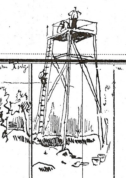
| Site of artist tower at left looking at center of paintingk Atlanta skyline behind (Courtesy AHC) |
Decatur Road featured prominently in the July 22, 1864, battle, says Charlie Crawford, president emeritus of the Georgia Battlefields Association. Of course, it was a dirt road during the Civil War, and had it owns share of potholes and ruts. Commanders used the road to carry men, materiel and artillery.
 |
| The view toward Stone Mountain in Cyclorama; Decatur Road to right (Courtesy AHC) |
“It was also a main approach route for the Army of the Tennessee prior to the battle,” says Crawford, referring to a large Federal unit under the command of Maj. Gen. James B. McPherson, who moved his troops from Decatur toward advancing Confederates.
 |
| Charlie Crawford drew red lines showing road in Cyclorama |
Mary-Elizabeth Ellard, GBA secretary and trustee, operates a veterinary practice along DeKalb Avenue. “Many people forget that they live/work/play on a battlefield,” she says.
I turned this week to the Atlanta Campaign History and Discussion Group Facebook page for feedback on the road’s Civil War history.
Admin Brad Butkovich mentioned fighting in
what is now called the nearby Little Five Points neighborhood and the various
markers that indicated troop positions and action.
“Many markers have been moved as roads and intersections have expanded and changed over the years,” one Facebook reader says.
Much of the
Battle of Atlanta occurred along and near the north-south Moreland Avenue,
which cuts under DeKalb Avenue and through Little Five Points. (Moreland Avenue is depicted
in a 1964 map above that has an overlay of the repaving project.)
 |
| MARTA rail line (left) along DeKalb Avenue (Picket photo) |
“While this route may be a high-traffic residential road today, in
1864 it was little more than undeveloped farmland -- unremarkable in every way
except its role as the dividing line between Fulton and DeKalb counties.
However, as Sherman’s Federal armies made their way towards Atlanta, this
undistinguished strip of land would become the site of some of the fiercest
fighting experienced by participants of the Atlanta Campaign in the American
Civil War.”

The road was
mentioned during the 1939 film “Gone with the Wind.” The fictional Frank
Kennedy, a business owner and Klansman, took part in a raid on a shantytown,
ostensibly as revenge for an attack on Scarlett O’Hara.
O’Hara asks
Rhett Butler about the whereabouts of her second husband.
“He’s lying
out on the Decatur Road,” Butler replies. “Shot through the head. He’s dead.”
The $5.4 million project aims to make everyone safer, especially with the formal end of
reversible lanes. I drove the stretch this week and was heartened to see much
of it already paved. Work is expected to be completed in August.
 |
| Road work near old textile mill in Cabbagetown area (Picket photo) |
 |
| Troup Hurt House is focal point of the Cyclorama (Picket photo) |
No comments:
Post a Comment